Most of the maps below are available in three sizes full, medium and small. You can choose any of them based on what you want to do with the map. The small size is good to get a look at some of the detail and will load quickly. They are usually under a megabyte in size. Most of the Medium size maps will load in the web page and will show much more detail. Some of them will only offer the option of downloading them to your device. The full size will need to be downloaded to your device but will have much more detail. These range in sizes of 10s of megabytes to 100s of megabytes. Have fun viewing our map collection. The originals are available for viewing by appointment.
1655 Lindstrom map
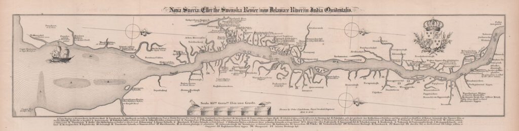
Thia map is one of the earliest maps of this area. It was commissioned by the Swedes in 1655 and engineer Peter Lindstrom went about drawing it. Below is the map and an addendum that show the names of most of the places in either English, Dutch, Swedish or Lenape. There are many different versions of this map. This copy is from the book “A HISTORY OF NEW SWEDEN; OR, THE SETTLEMENTS ON THE RIVER DELAWARE.” BY ISRAEL ACRELIUS published in 1876.
1655 Peter Lindstrom map Full Size 44.3m
1655 Peter Lindstrom map Medium Size 13.2m
1655 Peter Lindstrom map Small Size 3.7m
1655 Peter Lindstrom map addendum
——————————————————————-
1860-1 Philadelphia Region Gillette
1860 Gillette map excerpt from the internet
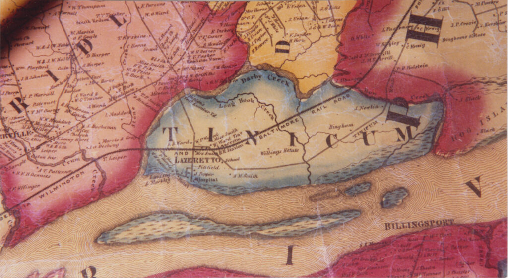
1861 Gillette map that we have an actual piece of it
This first map is an 1860 map of the Vicinity of Philadelphia Published by John E. Gillette and C. K. Stone. We just have a copy of that map from the internet. There is also a copy of that map published in 1861 without the townships outlined in colors published by just John E. Gillette. On this map just the counties are outlined in color. We have an actual piece of this 1861 map of Tinicum. One of the interesting things on this map is that Hog Island is in Philadelphia and not Delaware County like it should be. This is probably just an oversite because before this and after this map, Hog Island was in Delaware County.
1861 Gillette map of Philadelphia 4.1m
———————————————————————
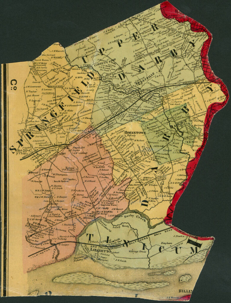
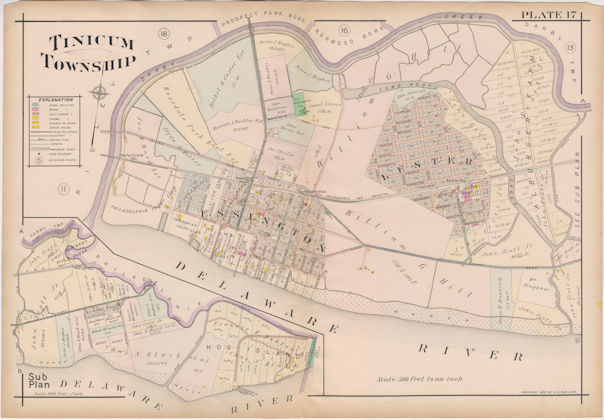
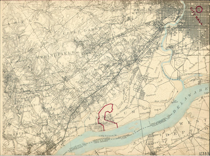
1870 Bethel/Tinicum map
1870 Hopkins Atlas of Delaware County, Tinicum shares a map with Bethel Township.
1870 Tinicum Part Full Size 3m
1870 Tinicum Part Medium Size 1m
1870 Tinicum Part Small Size 370k
——————————————————————-
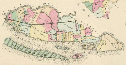
1875 E B porter
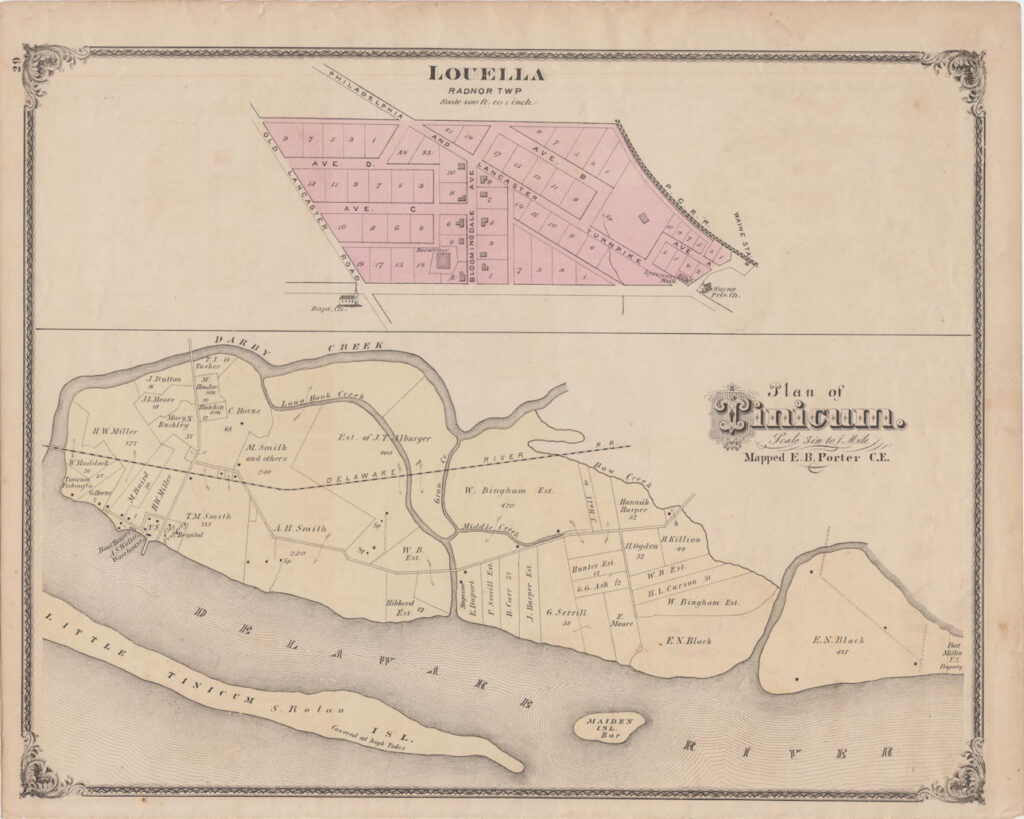
1875 E. B. Porter of Delaware County, Tinicum shares the map with Louella in Radnor Township
1875 E. B. Porter Map Full Size 11m
1875 E. B. Porter Map Medium Size 3m
1875 E. B. Porter Map Small Size 790k
——————————————————————-
1880 Atlas
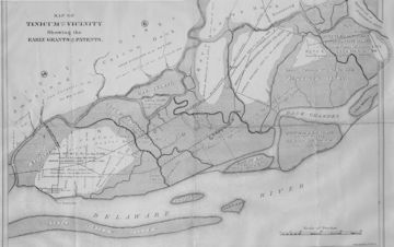
Here is a copy of the 1880 Atlas of Delaware County showing the Early Grants; Patents by Benjamin H. Smith that was in the personal collection of Bob Mills
——————————————————————-
1889 Philadelphia Wilmington and Baltimore railroad maps
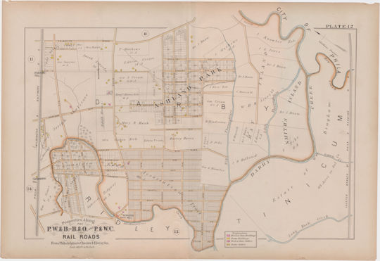
Plate 12 shows the East part of Tinicum along the right edge of the map.
1889 Plate 12 Medium Size 7.4m
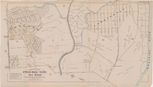
Plate 13 shows the Middle part of Tinicum on the right side of the map.
1889 Plate 13 Medium Size 8.3m
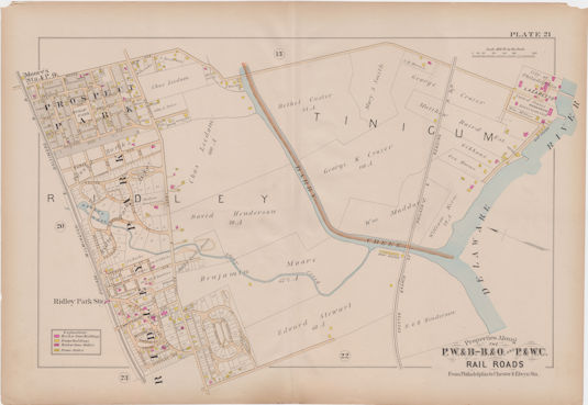
Plate 21 shows the western part of Tinicum on the upper right side of the map.
——————————————————————-
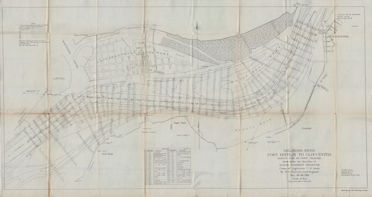
1890 Hotel Essington
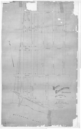
The 1890 map of the land owned by what will be the Corinthian Yacht club.
1890 Hotel Essington Map Full Size 17m
1890 Hotel Essington Map Medium Size 5.5m
1890 Hotel Essington Map Small Size 1.2m
——————————————————————-
1892 tinicum
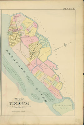
1892 Smith Atlas of Delaware County, Tinicum shares a map with Marcus Hook and Linwood
1892 Tinicum Part Full Size 9.3m
1892 Tinicum Part Medium Size 3m
1892 Tinicum Part Small Size 860k
——————————————————————-
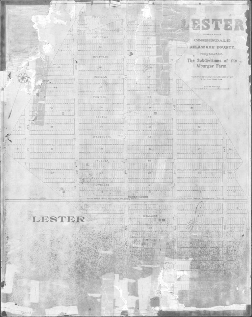
1888 Alburger Farm Map
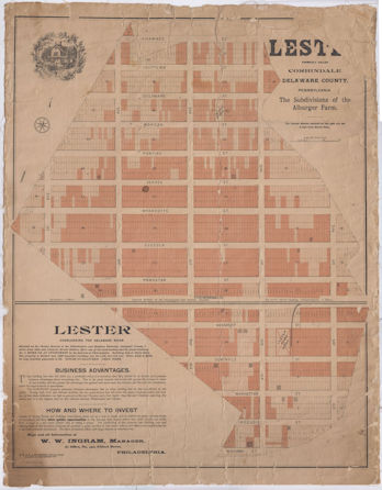
The Alburger Farm Map was used to subdivide building lots. It was called Corbindale at the time. There is no date on this map, but we think it was somewhere between 1890 and 1909. It wasn’t till after 1890 that Lester Piano was thinking about a new home for their factory. The factory does not show up in the 1892 but does show up on the 1909 Mueller map. The number of homes and location on the Alburger Farm map more closely matches the 1892 map and Corbindale is still listed on the 1892 map. Corbindale was renamed to Lester in 1888 so the map was probably very close to 1888. The renaming of the town might have been the catalyst for this map.
Alburger Farm Map Full Size 46.5m
Alburger Farm Map Medium Size 3m
Alburger Farm Map Small Size 500k
——————————————————————-
Circa 1900 Essington Land Development map
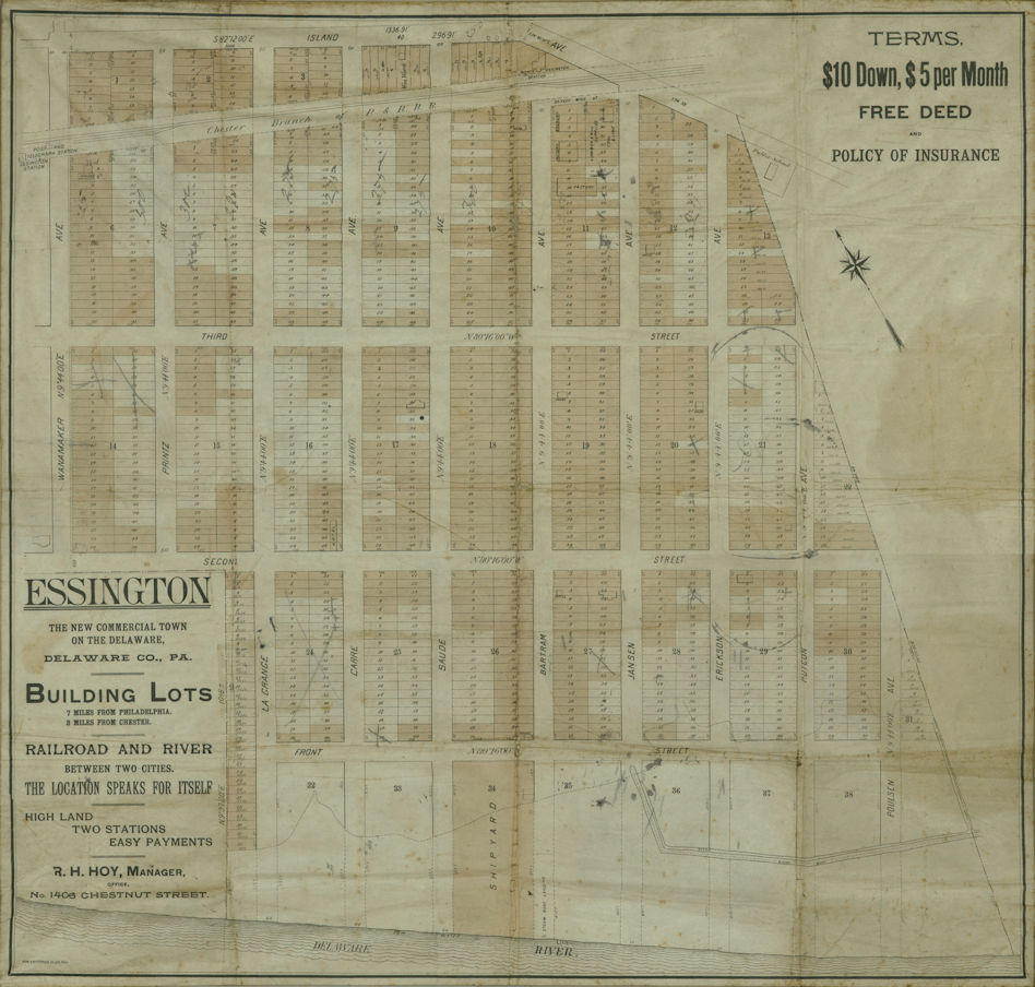
Essington Land Development map from around 1900 (there is no date on the map). From the collection of Bob Mills.
Essington Land Development Full Size 22.6m
Essington Land Development Medium Size 7m
Essington Land Development Small Size 2.2m
——————————————————————-
1909 Mueller
1909 A. H. Mueller real estate map of Tinicum
1909 Mueller medium size 11.5m
——————————————————————-
1910 Delaware River sounding maps
This is a set of 14 Delaware river and bay depth maps from Bombay Hook Point to just above the Ben Franklin bridge. There is also a ‘index’ map that shows where all the detailed maps start and stop. These are from the government published book “Delaware river maps” from 1910
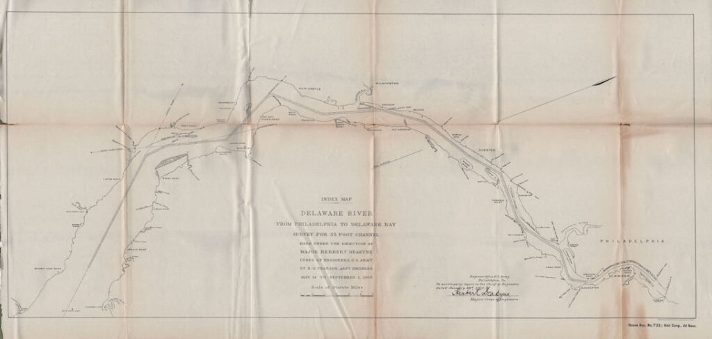
This is the index map showing where the other maps are located
Delaware river sounding maps index Full Size 21.7m
Delaware river sounding maps index Medium Size 5.2m
Delaware river sounding maps index Small Size 1.2m
Sheet 1 Bombay Hook Point to Liston Point
Sheet 1 Bombay Hook Point to Liston Point Full Size 21.7m
Sheet 1 Bombay Hook Point to Liston Point Medium Size 5.2m
Sheet 1 Bombay Hook Point to Liston Point Small Size 1.2m
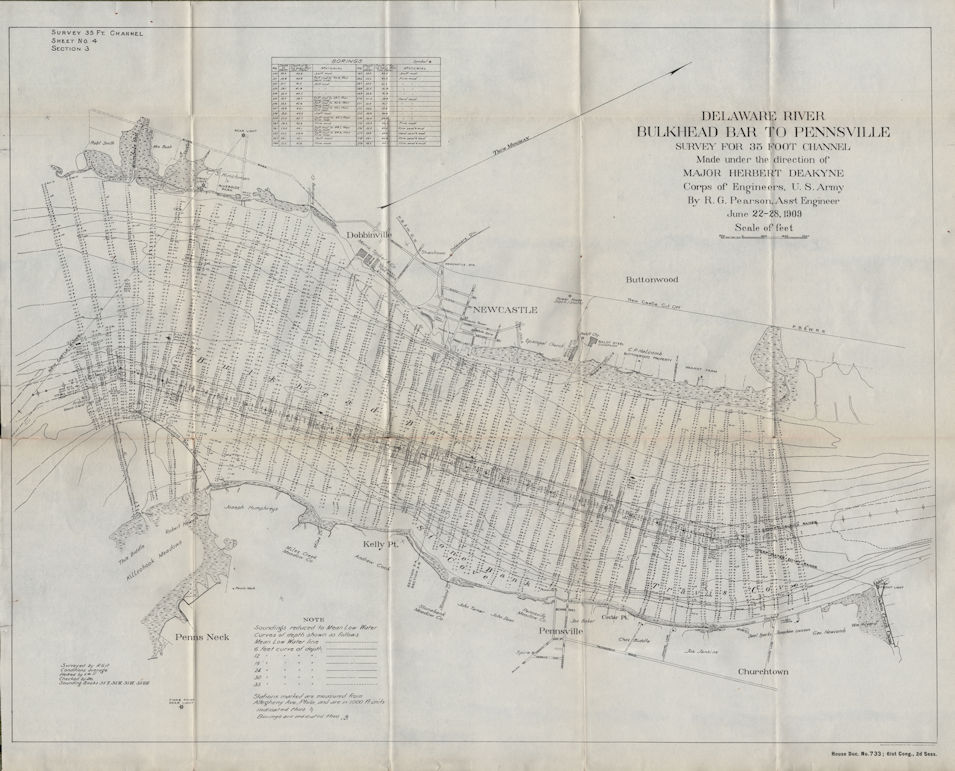
Sheet 4 Bulkhead Bar to Pennsville
Sheet 4 Bulkhead Bar to Pennsville Full Size 30.2m
Sheet 4 Bulkhead Bar to Pennsville Medium Size 8.2m
Sheet 4 Bulkhead Bar to Pennsville Small Size 2.3m
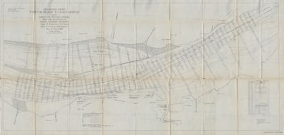
Sheet 7 Marcus Hook to Eddystone
Sheet 7 Marcus Hook to Eddystone Full Size 51m
Sheet 7 Marcus Hook to Eddystone Medium Size 14m
Sheet 7 Marcus Hook to Eddystone Small Size 3.6m
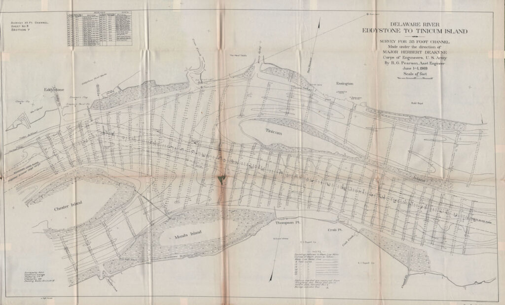
Sheet 8 Eddystone to Tinicum Island
Sheet 8 Eddystone to Tinicum Island Full Size 38m
Sheet 8 Eddystone to Tinicum Island Medium Size 10.2m
Sheet 8 Eddystone to Tinicum Island Small Size 2.7m
Sheet 9 Tinicum Island to Fort Mifflin
Sheet 9 Tinicum Island to Fort Mifflin Full Size 48.4m
Sheet 9 Tinicum Island to Fort Mifflin Medium Size 13.1m
Sheet 9 Tinicum Island to Fort Mifflin Small Size 3.3m
Sheet 10 Fort Mifflin to Gloucester
Sheet 10 Fort Mifflin to Gloucester Full Size 43.5m
Sheet 10 Fort Mifflin to Gloucester Medium Size 11.8m
Sheet 10 Fort Mifflin to Gloucester Small Size 3.1m
——————————————————————-
1915 Amandus Johnson map
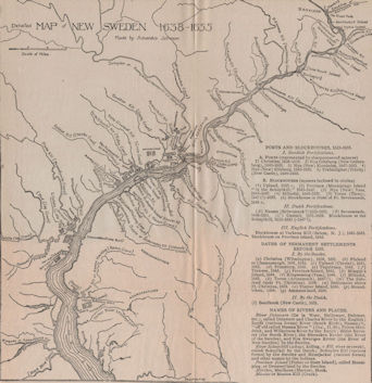
This copy is from the book “THE SWEDISH SETTLEMENTS ON THE DELAWARE THEIR HISTORY AND RELATION TO THE INDIANS, DUTCH AND ENGLISH 1638-1664” by AMANDUS JOHNSON, PH.D. 1911. It covers about the same area that the 1655 Lindstrom map.
1915 Amandus Johnson map Full Size 18.4m
1915 Amandus Johnson map Medium Size 5.9m
1915 Amandus Johnson map Small Size 1.7m
——————————————————————-
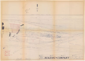
1917 Reading Darby Creek Yard
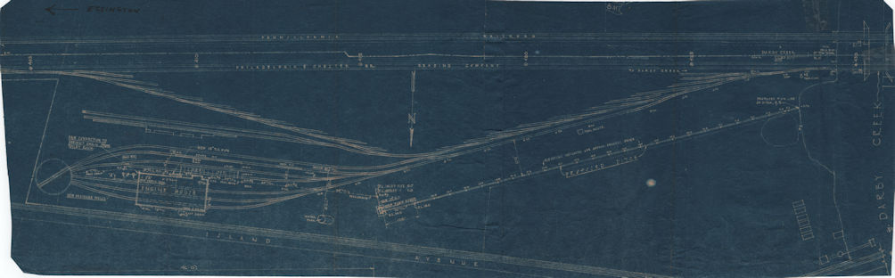
A layout of how the tracks were arranged in the Darby Creek Yard in 1917. The only date on this blueprint is written on the back as 1917. It might be a different date since all of our other Reading Darby Creek Yard Blueprints have a date printed when the copy was created. For now, we will go with 1917 date since it is plausible.
1917 Reading Darby Creek Yard Full Size 155.3m
1917 Reading Darby Creek Yard Medium Size 12.2m
1917 Reading Darby Creek Yard Small Size 3.1m
——————————————————————-
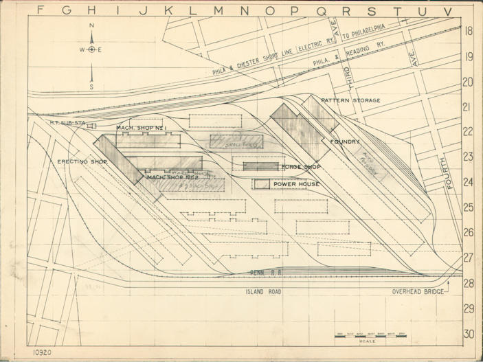
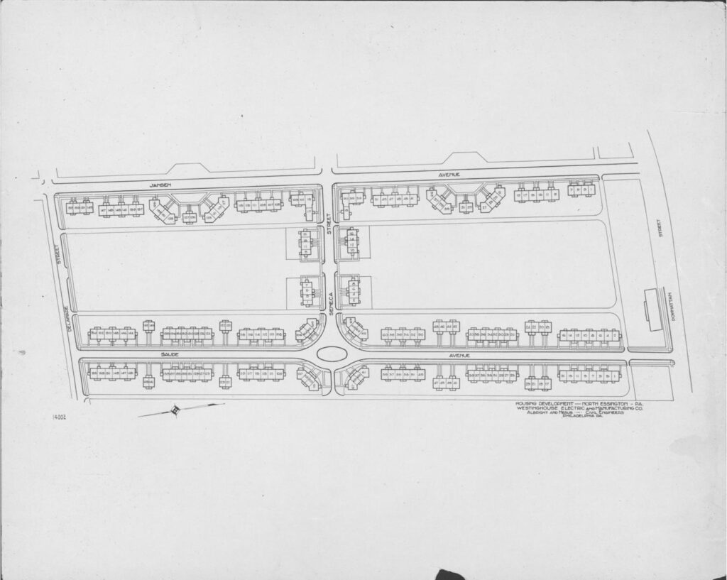
1918 Westinghouse Complex
1918 map of the overall size and location of the Westinghouse Complex
1918 Westinghouse 01 Full Size 3.8m
1918 Westinghouse 01 Medium Size 1.4m
1918 Westinghouse 01 Small Size 470k
1918 map of the overall size and location of just the Westinghouse Complex
1918 Westinghouse 02 Full Size 3m
1918 Westinghouse 02 Medium Size 819k
1918 Westinghouse 02 Small Size 284k
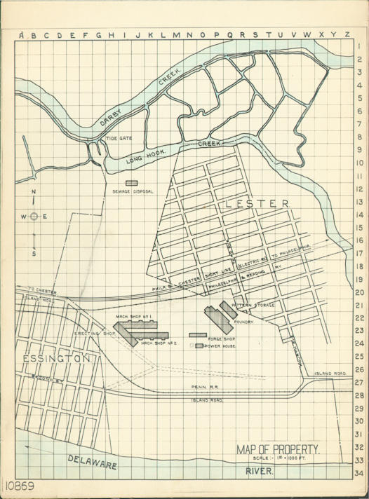
1918 map of the overall size and location of the Westinghouse Complex within the towns of Essington and Lester
1918 Westinghouse 03 Full Size 3.1m
1918 Westinghouse 03 Medium Size 859k
1918 Westinghouse 03 Small Size 301k
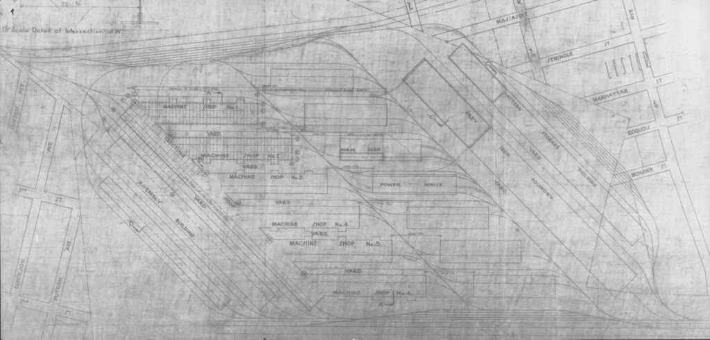
1918 A more detailed map of the overall Westinghouse Complex.
1918 Westinghouse 04 Full Size 8.5m
1918 Westinghouse 04 Medium Size 2.1m
1918 Westinghouse 04 Small Size 708k
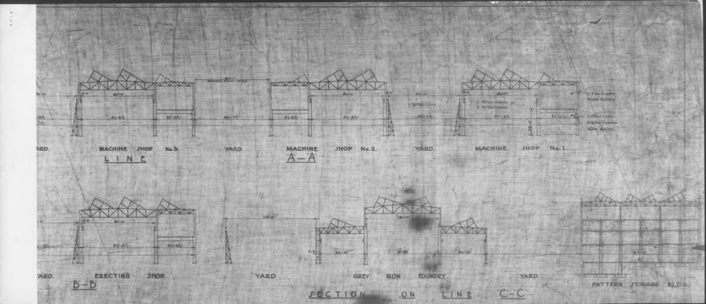
1918 An elevation line drawing of the buildings in the Westinghouse Complex.
1918 Westinghouse 05 Full Size 8.5m
1918 Westinghouse 05 Medium Size 2.1m
1918 Westinghouse 05 Small Size 708k
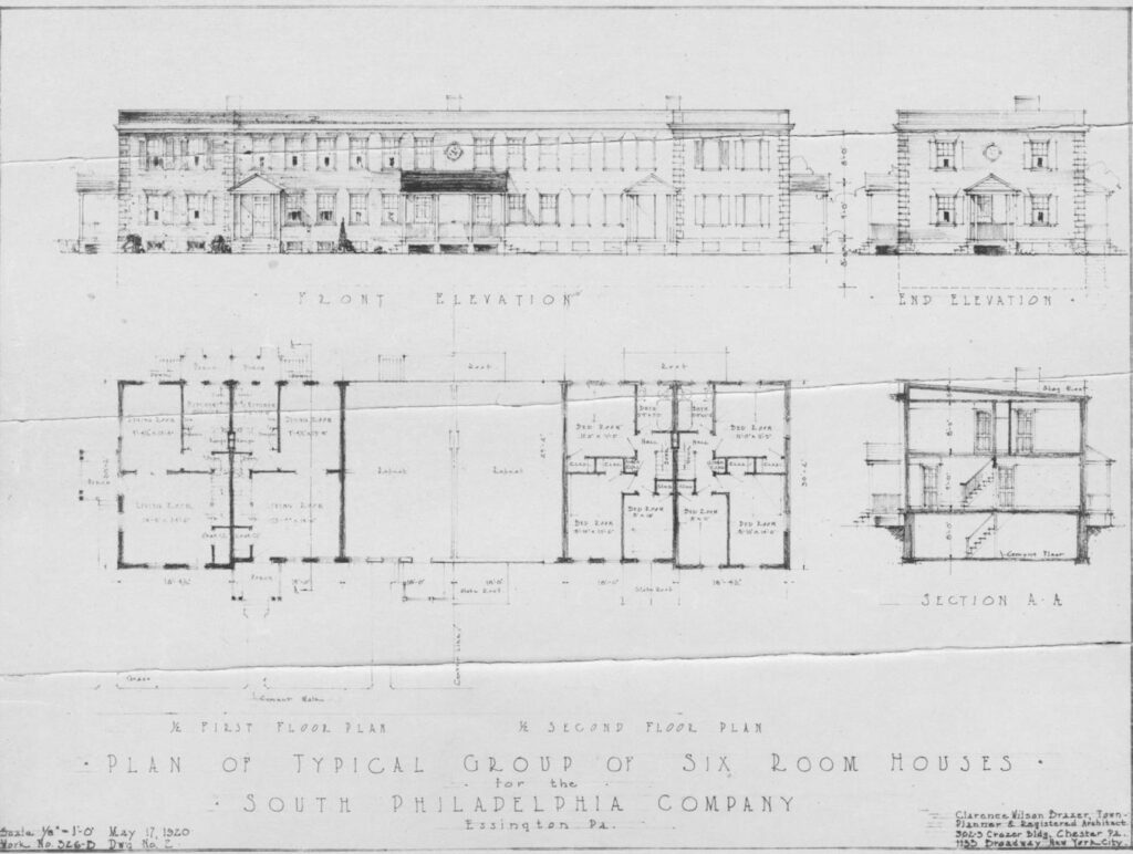
1918 A floor plan of housing similar to Westing House Village but more like housing for single men. I believe this is a plan for housing that was proposed but never built.
1918 Westinghouse 06 Full Size 1.8m
1918 A Layout plan of housing for Westinghouse Village. They were going to build more similar housing but never built. you can see at the top of the plan where the extra housing was planned.
1918 Westinghouse 07 Full Size 2.1m
——————————————————————-
1919 Sanborn Fire Insurance maps of Lower Delaware County.
These maps are from a Sanborn fire insurance map book for part of Delaware County. These maps were used to rate the insurability of a property based on the buildings on the property. The base map is from 1919 but every so often the Sanborn Map Company would issue ‘updates’ in the form of paper cutouts that were to be glued over the maps in the map book. The last update for these maps was from 1966. At the moment we have loaded out the maps that are from Tinicum. In the future we will add in the maps from other parts from the map book.
We divided the individual maps into two different groups, those inside Tinicum and those outside Tinicum.
——————————————————————-
1926 these are sort of Real-estate Atlas in form but much plainer. We just have some of the ones for Tinicum but not all of them. We have never been able to find out who produced them but now that it is 100 years since they were produced, we are confident that they are now in the public domain so here they will be when i get them loaded.
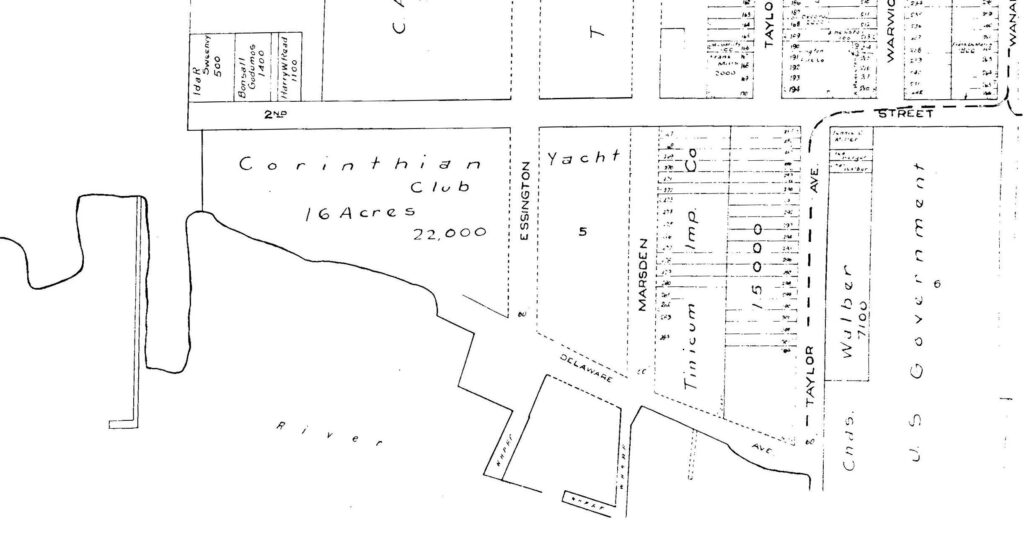
Plate 63 Darby Tinicum Folcroft Norwood
——————————————————————-
1930 blueprint maps of Lester. We converted them to black and White to better view them.
This map is very close to the 1888 map of the Alburger Farm map. There is no date on the map, but is similar to the next map in form.
1930 Blueprint Map 1 Full Size 17.2m
1930 Blueprint Map 1 Medium Size 6m
1930 Blueprint Map 1 Small Size 1.7m
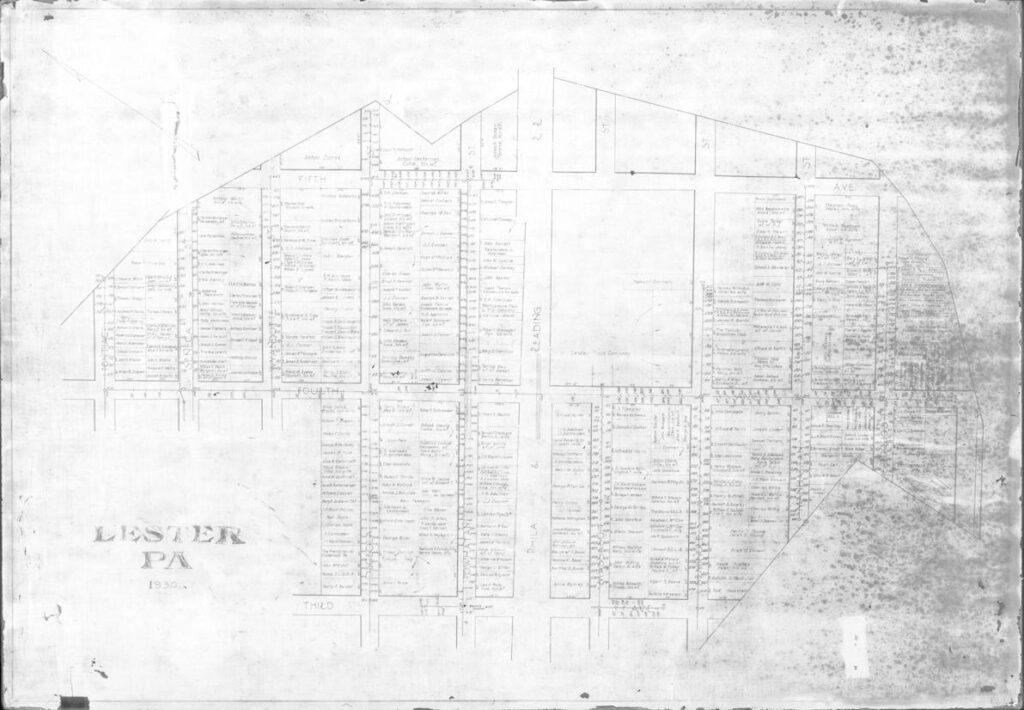
This map does have a date of 1930 and is of the same general area, but this one has owners of plots written in. It is also turned on its side to give more room for names on the plots.
1930 Blueprint Map 2 Full Size 16.8m
1930 Blueprint Map 2 Medium Size 5.9m
1930 Blueprint Map 2 Small Size 1.7m
——————————————————————-
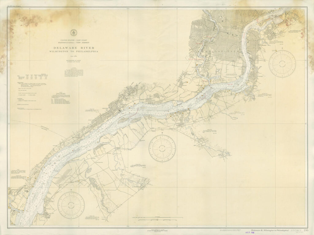
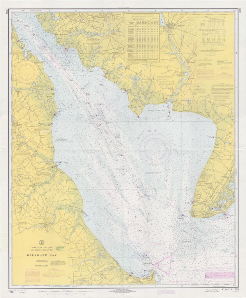
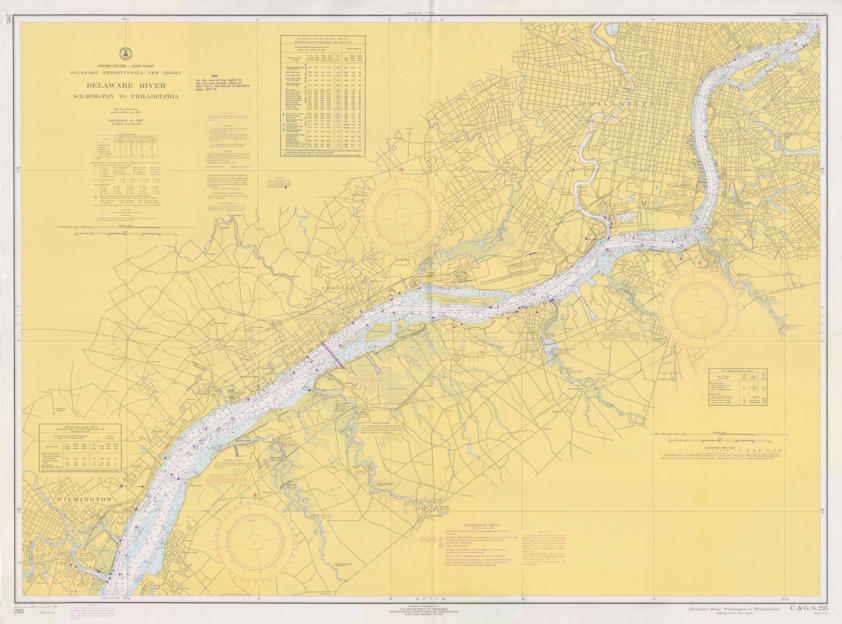
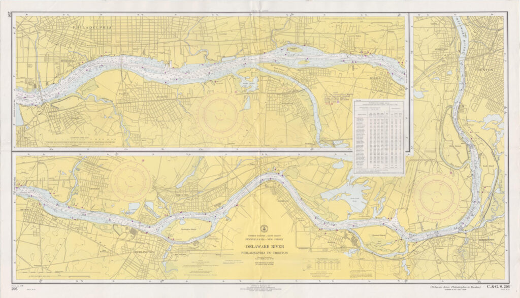
1934 Nautical Chart of Delaware River from Wilmington to Philadelphia
1934 Nautical Chart Full Size 12.4m
1934 Nautical Chart Medium Size 3.6m
1934 Nautical Chart Small Size 982k
——————————————————————-
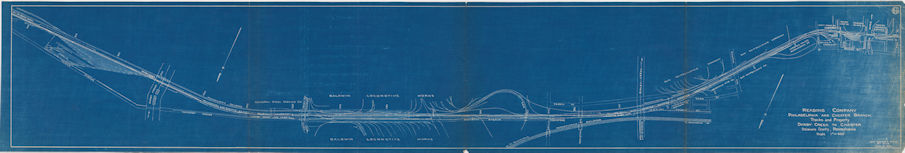
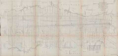
1938 This is a map of the reading tracks from Tinicum down into Chester
1938 Reading Tracks Along the Delaware Full Size 24m
1938 Reading Tracks Along the Delaware Medium Size 6.5m
1938 Reading Tracks Along the Delaware Small Size 1.5m
——————————————————————-
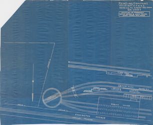
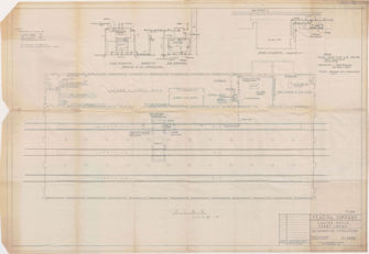
1944-08-09 Reading Darby Creek Yard just around the turn table and the engine house
1944-08-09 Reading Darby Creek Yard Full Size 11.8
1944-08-09 Reading Darby Creek Yard Medium Size 3.2m
1944-08-09 Reading Darby Creek Yard Small Size 789k
——————————————————————-
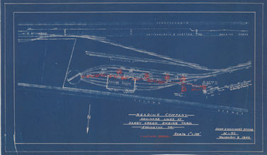
1944-11-09 Reading Darby Creek Yard Full view from the turn table to Darby Creek
1944-11-09 Reading Darby Creek Yard Full Size 12.8m
1944-11-09 Reading Darby Creek Yard Medium Size 3.5m
1944-11-09 Reading Darby Creek Yard Small Size 863k
——————————————————————-
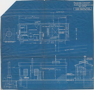
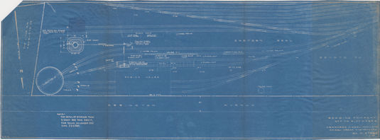
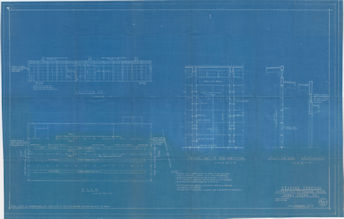
1945 Reading Engine Facilities Partial View. This shows the Sand Drying House dimensions.
1945 Reading Engine Facilities Full Size 16.8m
1945 Reading Engine Facilities Medium Size 4.3m
1945 Reading Engine Facilities Small Size 1.1m
——————————————————————-
1950-07-07 Reading Darby Creek Yard shows the yard from the turntable to almost Darby Creek.
1950-07-07 Reading Darby Creek Yard Full Size 17m
1950-07-07 Reading Darby Creek Yard Medium Size 4.6m
1950-07-07 Reading Darby Creek Yard Small Size 1.1m
——————————————————————-
1953 Aircraft Flight Chart of the Philadelphia Area. This chart hung in Bob Mills office. If you look across from Wilmington, you can see where the Philadelphia Sea Plane Base had a practice area. Both of these maps had to be modified to remove most of the damage from exposure to sunlight for 50 years. Most of the Reds and Yellows have mostly been faded away to bring out the detail.
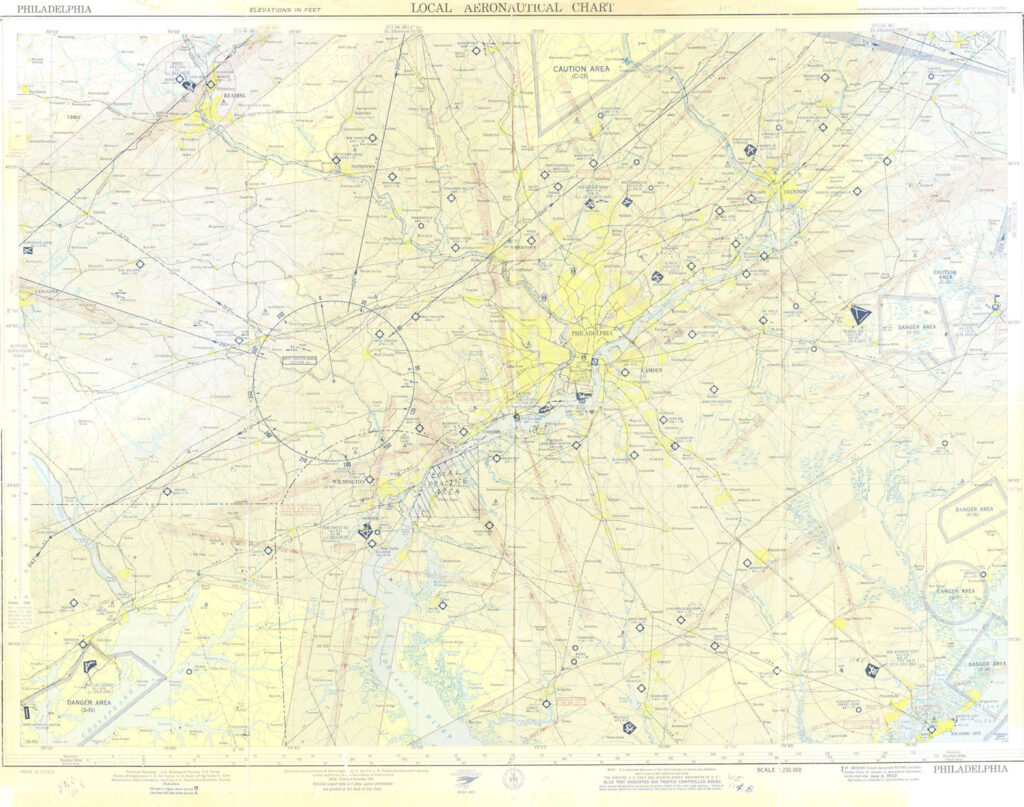
1953 Bob Mills flight map front Full Size 202.9m
1953 Bob Mills flight map front Medium Size 9.9m
1953 Bob Mills flight map front Small Size 2.1m
The back of the chart with the legend detail.
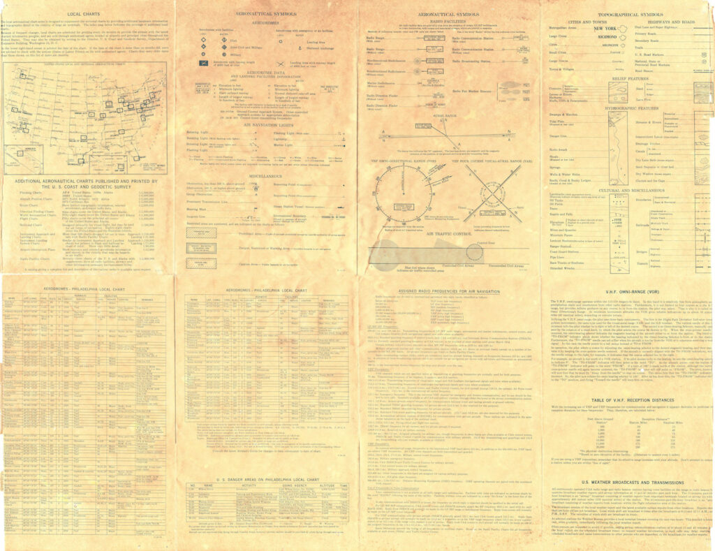
1953 Bob Mills flight map back Full Size 295m
1953 Bob Mills flight map back Medium Size 9.1m
1953 Bob Mills flight map back Small Size 2.1m
——————————————————————-
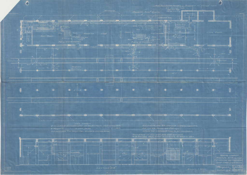
1954-04-29 1 Reading Engine Facilities dimensions of the engine house.
1954-04-29 1 Reading Engine Facilities Full Size 32.5m
1954-04-29 1 Reading Engine Facilities Medium Size 9.3m
1954-04-29 1 Reading Engine Facilities Small Size 2.3m
——————————————————————-
1954-04-29 2 Reading Engine Facilities more views of the engine house.
1954-04-29 2 Reading Engine Facilities Full Size 42.8m
1954-04-29 2 Reading Engine Facilities Medium Size 10.9
1954-04-29 2 Reading Engine Facilities Small Size 2.3m
——————————————————————-
1964 Reading Engine Facilities more engine house plans
1964 Reading Engine Facilities Full Size 33.3m
1964 Reading Engine Facilities Medium Size 8.9m
1964 Reading Engine Facilities Small Size 2.2m
——————————————————————-
1970 Nautical Chart of Delaware River and Bay in three parts.
1970 Part One of Nautical Chart of Delaware River and Bay Full Size 51.5m
1970 Part One of Nautical Chart of Delaware River and Bay Medium Size 15.2m
1970 Part One of Nautical Chart of Delaware River and Bay Small Size 4.4m
1970 Part Two of One of Nautical Chart of Delaware River and Bay Full Size 67.8m
1970 Part Two of One of Nautical Chart of Delaware River and Bay Medium Size 20.5m
1970 Part Two of One of Nautical Chart of Delaware River and Bay Small Size 5.8m
1970 Part Three of One of Nautical Chart of Delaware River and Bay Full Size 46.5m
1970 Part Three of One of Nautical Chart of Delaware River and Medium Size 14.1m
1970 Part Three of One of Nautical Chart of Delaware River and Small Size 4.4m
——————————————————————-
1972 Reading Darby Creek Yard from the turn table to almost Darby Creek
1972 Reading Darby Creek Yard Full Size 27.5m